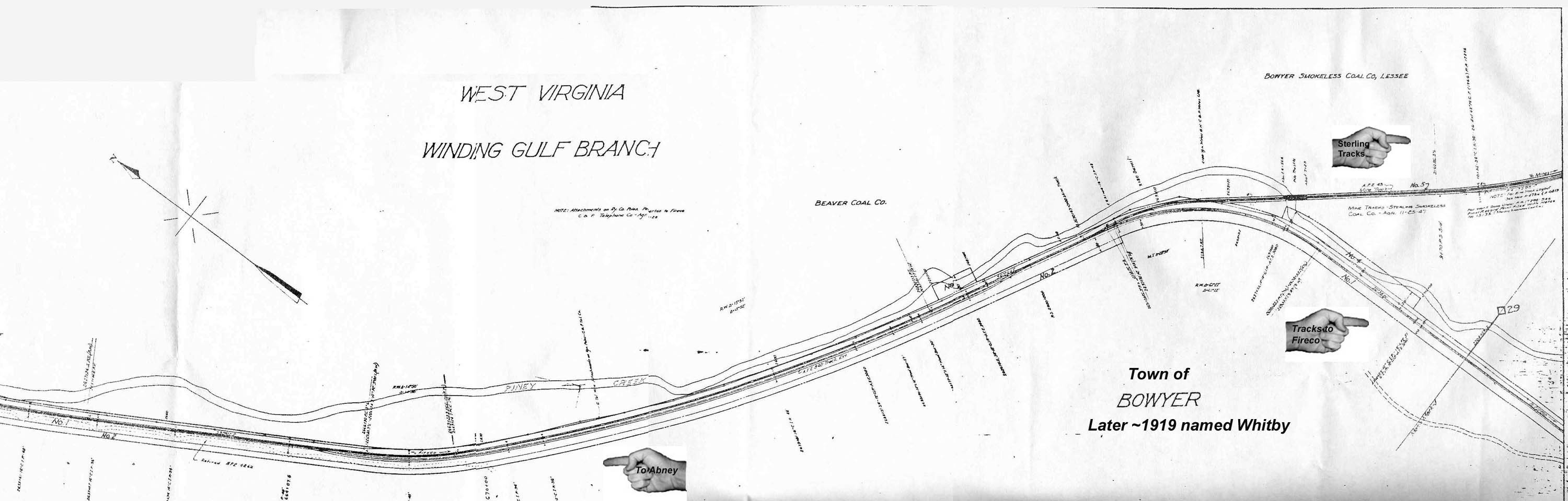
Thanks to Tom Salmon and the Norfolk and Western Archives, below is the only map of the town of Bowyer and its rail facilities that I know of. Bowyer, was one of the earliest names for the area we now call Whitby. This map has some great features which I have used hands to point out. Thanks to Jack Sisk for the following information:
"NOTE the hand pointing to the Sterling Smokeless tracks. This was completed in ~1947. These tracks went up to Halstead Hollow nearby the Halstead cemetery. These tracks were for strip mining." Thanks again Jack.
It should be noted that Jacks father was Walter Sisk, the Whitby Mine Track man. His main duty was to make certain that the track being created was safe to use and properly built within the mines at Whitby. Coincidentally, most of the track nails I have found for Whitby are dated 1947.
The map itself was originally created in 1917. The best parts are the land owners and the dates. Beaver Coal owned the land and in 1917 leased this to Bowyer Smokless. Beaver Coal never worked coal, they are a property company only. Oddly enough, all scrip (company money) at Bowyer, spells the company name as Boyer, the w was dropped. There is a link below to a sample piece of Bowyer scrip.
There are more details of leasing history on the main Whitby page here. Additionally, there is a Whitby Postal Application dated December of 1918 showing a town named Whitby as well as yet another Whitby town name: Stahl. Both names appear on the application here.
So, we now know that the town of Whitby has had at least 3 names AT THE SAME TIME. Ever try to figure out deed history on a town that has 3 names? Its fun, really...